
Beyond Kingswear, the trackbed follows the river beneath the steep slope of Hoodown, rising as the eastern bank of the Dart valley. Even though the trackbed hugs the lower shoreline, it has still required the re-engineering and occasional surface levelling of the natural contours, so we can show the local features and character, as well as some of the engineering work enabling a workable single track route as far as Greenway, where the line is cut into the riverbank, and enters a tunnel. Due to space limitations, there has been some foreshortening and some sharper curves introduced to get the job done.
|
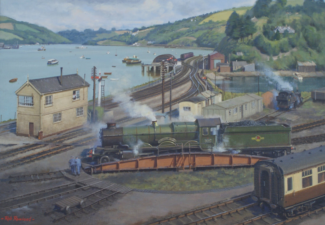
Kingswear turntable in the British Railways era in a painting by Rob Rowland. The River Dart with its lovely wooded valley and pleasure boats appears in the background, and our objective is to bring a similar scene to view and run it as it used to be. Luckily the railway and the village survive to this day and this has certainly helped matters when it comes to gathering reference!
|
|
|
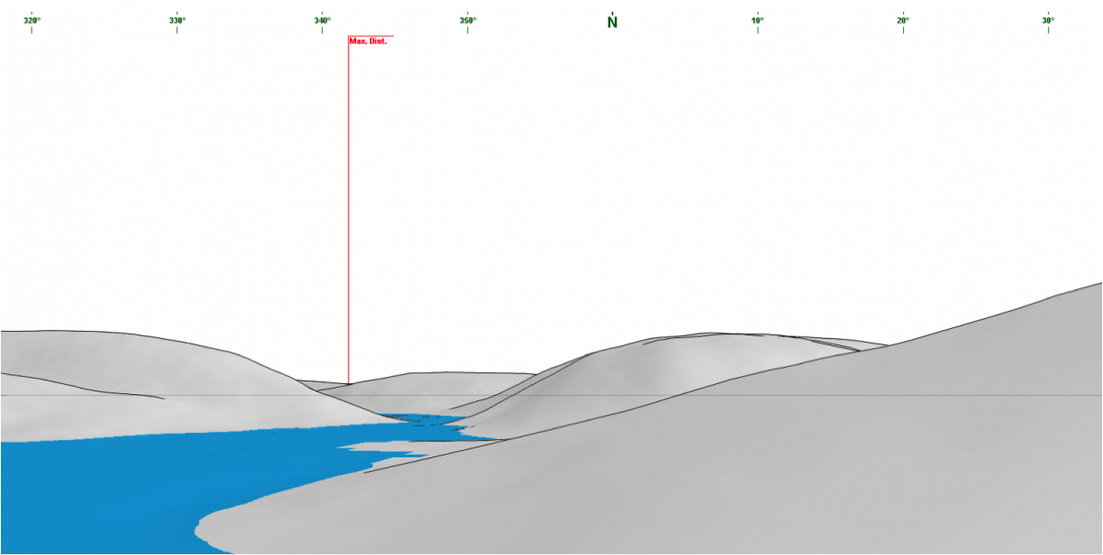
A ‘Generate a Panorama’ profile, looking north up the Dart valley. The line runs along the shoreline of the headland in the right foreground, with Hoodown to the right of this view, eventually curving round and just out of sight for a moment from this viewpoint as it deviates briefly inland to cross Noss Creek before re-emerging again to continue along the lower riverbank to the next headland before climbing to the North, away from the river, to disappear into the portal of Greenway tunnel.
|
|
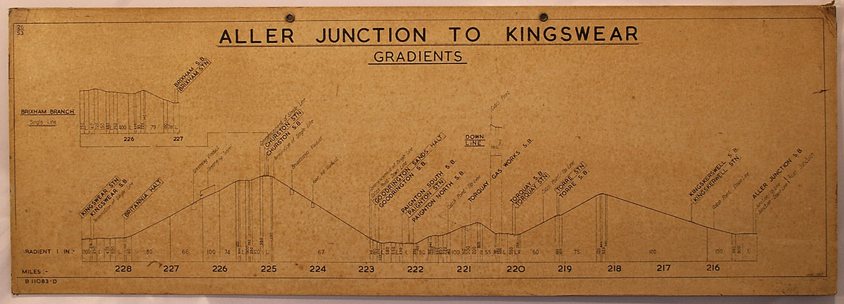
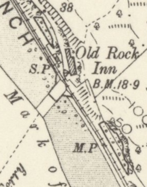
The original Signal Box gradient card from ALLER JUNCTION to KINGSWEAR for DARTMOUTH, also showing the Brixham Branch.
|
|
|
|
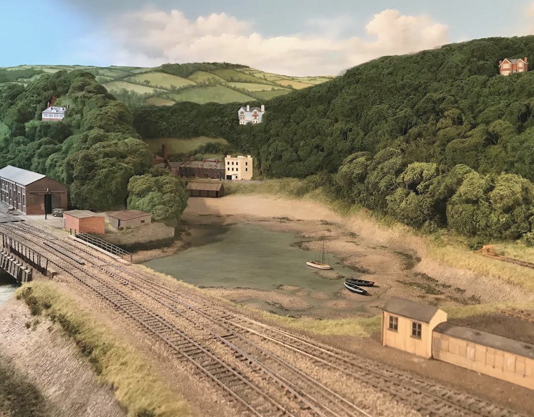
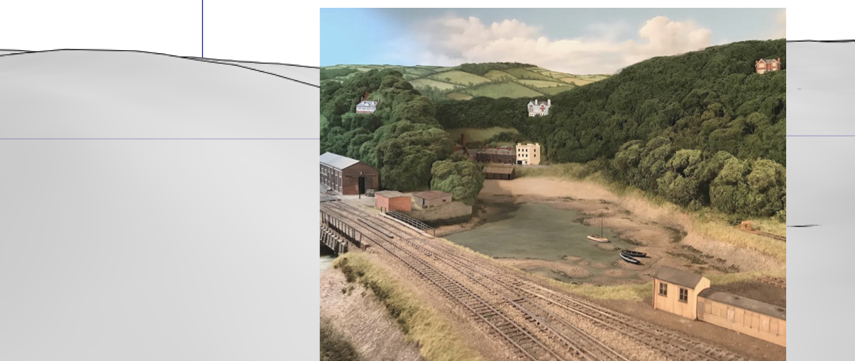
The Waterhead Creek section of Kingswear’s backscene is basically there now, only needing some continuation of cloud cover to the left and a few more small craft beached on the tidal mud, along with their mooring ropes.
To the left of Waterhead Creek, the line follows the shore for a short while before curving north, and above it, the steep section of the eastern riverbank facing Dartmouth is still known as Hoodown. It has reverted to forested land today, but 300 acres of what was then farm land was purchased by a Mr Richard Roberts in the late Victorian period to apply development ideas really in advance of his time. No doubt influenced by what he saw happening in other Victorian seaside towns, he cut a series of 14 foot wide roads, with the lower side half held up by a 4 foot high dry stone wall, using local materials. and advertised the sale of building plots. Had he had his way, the land at Kingswear, facing the Dart, would have been fully built up like that at Torbay and other south coast towns.
|
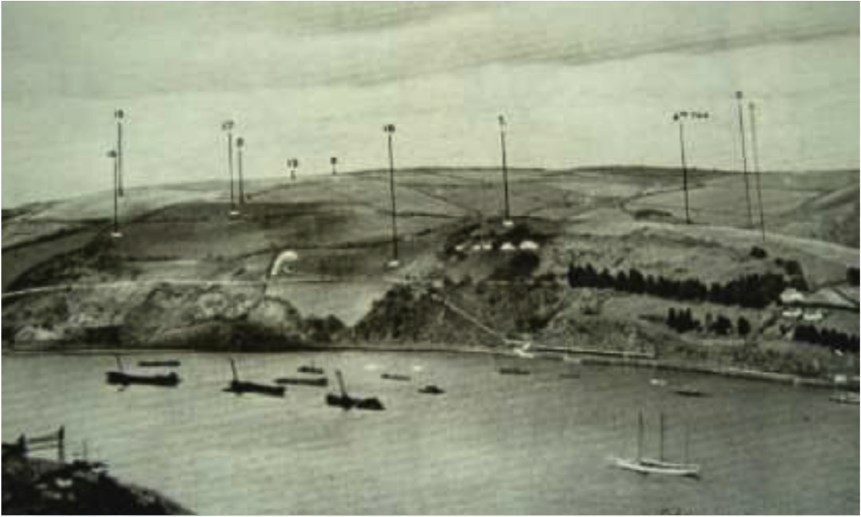
The width of the roads must have been considered adequate, for at that time the motor car had hardly been conceived, and shortly after this, rows of fir trees were planted, (as seen in the photo), which stood intact for 70 years or more, after which westerly gales blew them down one by one, until by now only the odd one or two are left standing. Even after many years only two plots had been sold, and the larger part of the land, which was then almost treeless, was ploughed up and put to potatoes, and the land produced good crops. After the end of the war in 1918, the steep land was abandoned and reverted largely to bracken and scrub, but the large rabbit population kept the grassy areas bitten down so the vegetation was considerably different to what it is today. luckily, we do have reference for the way it appeared, and here’s a relatively tree-less Hoodown in 1936. John S. Roberts
|
|
|
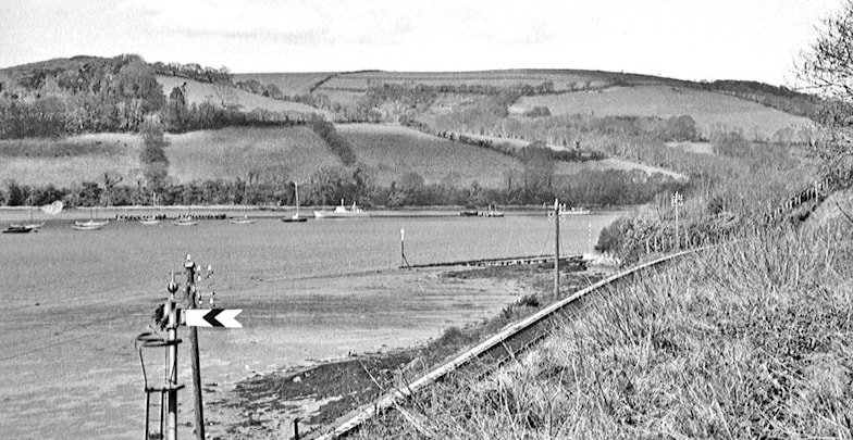
Up distant signal, approaching the Steam ferry crossing, the ramp of which can be seen in the background.
|

|
|
|
|
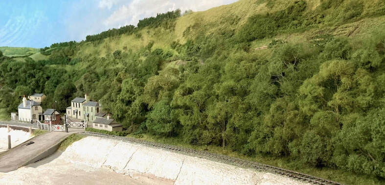
Neil's scenic cover and foliage at Higher Ferry. The built up stone riverbanks and railway ballast still need doing, along with the silt and ebb tide water, but the woodland, scrub land and coniferous treeline above the ferry crossing are finished, so there's only the foreground to do now.
|
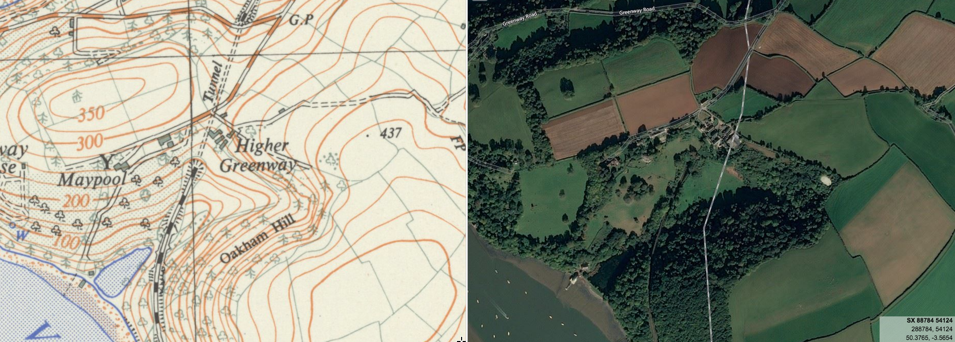
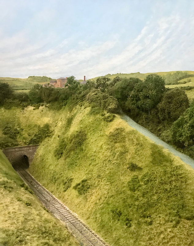
Greenway tunnel portal and its surroundings will form the scenic break for this layout and this satellite crop shows the line as it heads underground for 495-yards, emerging again near the Greenway estate and the historic home of Agatha Christie on its way towards Paignton (a little under 5 miles to the North)
|
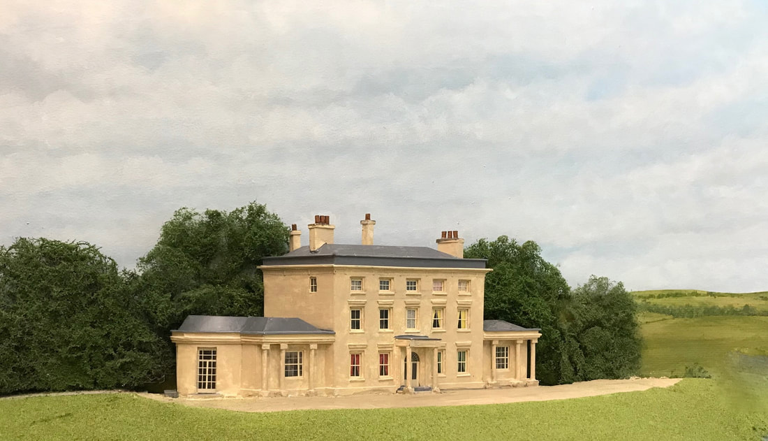
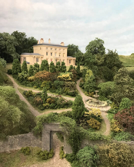
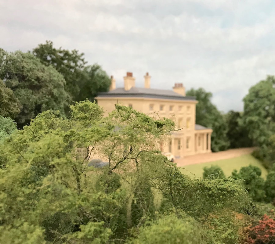
Greenway House was set into landscaped gardens overlooking the River Dart, built between 1780 and 90 to replace a nearby Tudor structure, then remodelled and extended in the early 19th century in stuccoed stone rubble, with a slate hipped roof, and a parapet with dentilled cornice below. Three storeys and five bays with sash windows in the original south wall with vertical glazing bars only, Moulded architraves with cornices to first and ground storeys and a central plain round-headed doorway with semi-circular fanlight and glazed double doors, covered by a porch with Tuscan columns. Early 19th century single storey one bay wings to left and right have tripartite sash windows, complete with glazing bars and loggias each with two pairs of Tuscan columns supporting entablature. The left hand (west) wing has a wide segmental bow on west side. Stuccoed chimney stacks stand over side walls, with moulded cornices. In this part finished view, OS fields 522, 521 and 509 can be seen to right.
|
|
|
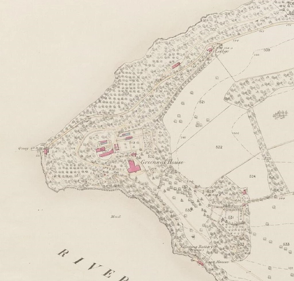
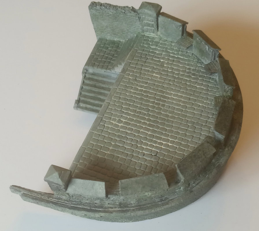
An 1854 OS map of the Greenway Estate, with gardens, orchards and cleared meadows beyond. Five walled gardens were set out around the house between 1791 and 1839 with the Camellia Garden set to the south west in an irregular walled enclosure with an east-west path. A stepped path from the Camellia Garden leads east to a circular walled seat, and another leads south to the Saluting battery, Bath house and Boat house. The Saluting battery indicated to the west of the bath house was built in 1839, with a sales document of 1851 stating that there was a 'battery of nine-pounder saluting cannons' upon a semicircular platform enclosed by a low crenellated stone wall with extensive views north-west and south along the River Dart. The Battery appears to have been part of the defences of the Dart estuary constructed during the Napoleonic wars. It is also shown on an estate map of 1839.
|
|
To the left hand side of the Greenway scenic break, we have represented a facade of the famous house, and as intended, it is now surrounded by trees and a small part of the formal gardens appears on the slope below.
|
|
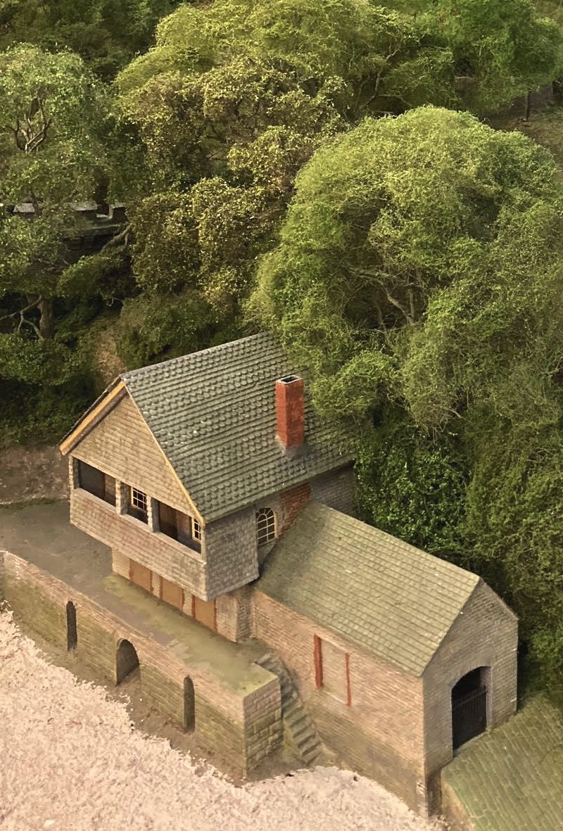
A bathhouse with a small stone rubble boathouse adjoining was constructed in the late 18th, or early 19th century to the south-east of Greenway House. The bathhouse comprises a lower storey, also of slate rubble, with arched round brick openings containing a rectangular stone-lined sunken plunge bath with iron balustrade and steps down. This was built into a jettied stone basement at beach level with three round-headed sluices allowing sea water to enter the bath by a sluice at high tide.
A rendered and shingled upper storey, with arched brick openings to the north, south and west facades provided a sitting room above, built with a small chimney piece to fireplace on it's side wall, and an open balcony facing the river. The building was formerly thatched. but now has a shingle roof over single gable and balcony. |
|
|
Dame Agatha gifted Greenway to her daughter Rosalind in 1959 and passing away 17 years later at the age of 85. Rosalind and her family eventually agreed to give this historic place together with Lower Greenway Farm (which we have represented a little to the east) to the National Trust.
|
|
