
Inevitably, little gems of information come to light during the sifting of recorded local history, so any passages and pictures that help describe the character of the surroundings can often bring an added interest to the modelling work.
|
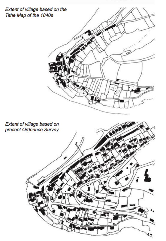
Kingswear has grown from a small fishing settlement with merchant’s houses, sail lofts and sheds mostly clustering around the western mouth of the Creek, into today’s largely residential village with buildings dispersed right over the headland. The population of the parish was 1332 in 2001, an increase of nearly 350% in 190 years, an increase derived from the redevelopment following the arrival of the railway in 1864 and the increased marine activity from the ferry pontoon and the coal wharf. The present character is far less industrial and many of the frontages have been rendered and painted in bright colours giving the village a very distinctive character and they stand out, especially when viewed from Dartmouth. As the reference indicates, there was far less of this evident in the 30s, with exposed grey natural stone rubble buildings and retaining walls, and later decorative all brick structures.

A small section of the east side of the Dart valley above the retaining wall for the station cut as it was. The gardens and allotments are nearly all built over now, with posh holiday homes reaching almost to the tree line.
|
|
|
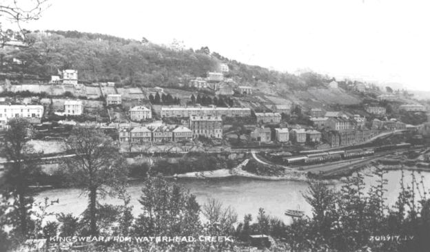
A postcard view, seen from the tidal inlet of Waterhead Creek. It's this view that we have reproduced in 3D, providing a landscape context for the layout that is in the process of being restored and finished as a permanent exhibit. It’s the late 40s, and the small village of Kingswear is spreading north from it’s headland opposite the larger settlement of Dartmouth, about a half a mile to the south of where this picture was taken. The upper half of the steep riverbank is still wooded, but many of the trees have been cleared away for houses and gardens. Small lanes have been cut, and stone retaining walls now provide step plateaus for new houses and hotels. The carriage sidings are visible near the shoreline to the right and just see how relatively small the trains appear in the landscape.
|
|
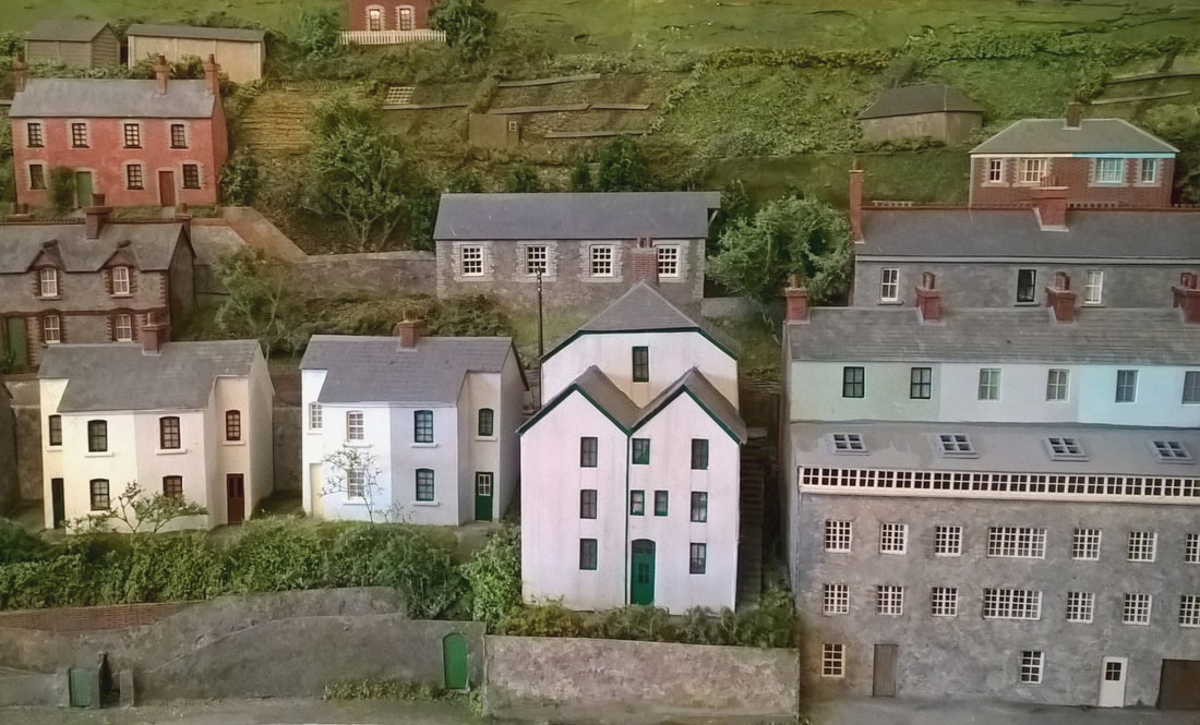
The stone retaining walls and narrow roadways allow access between the buildings, (some are merely footpaths), and the cleared gardens are simply represented as a patchwork quilt running down the steep sides of the creek. The small four windowed building at the centre of this thumb is the school, and it’s right hand gable was extended over the wooden brackets that hold the bell top pivot.
|
|
|
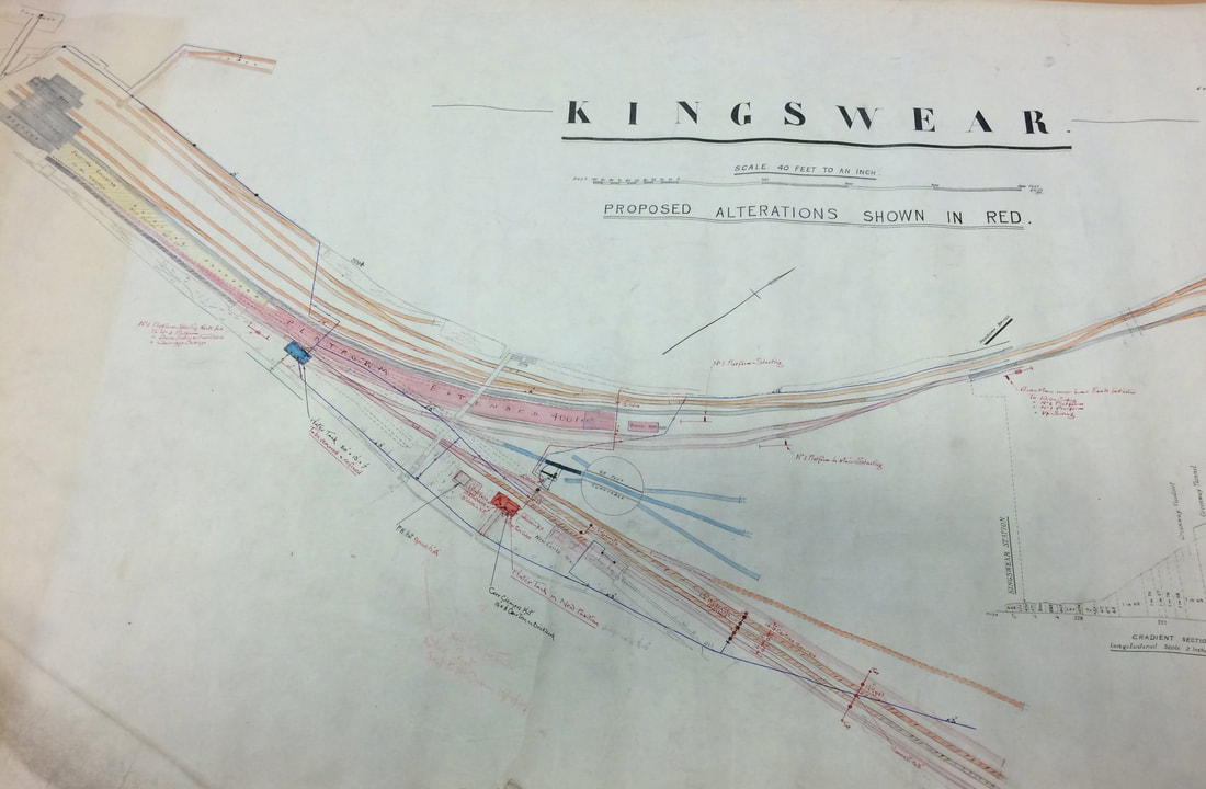
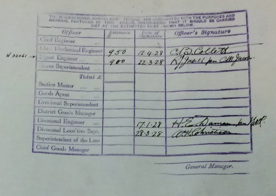
The proposed 1928 alterations are quite extensive and a stamp in the corner of this map bears the signature of C B Collett approving the cost of the new facilities.
|
|
This paragraph comes from Reg Little’s memories of his time living at Kingswear, the rest of which can be found here…
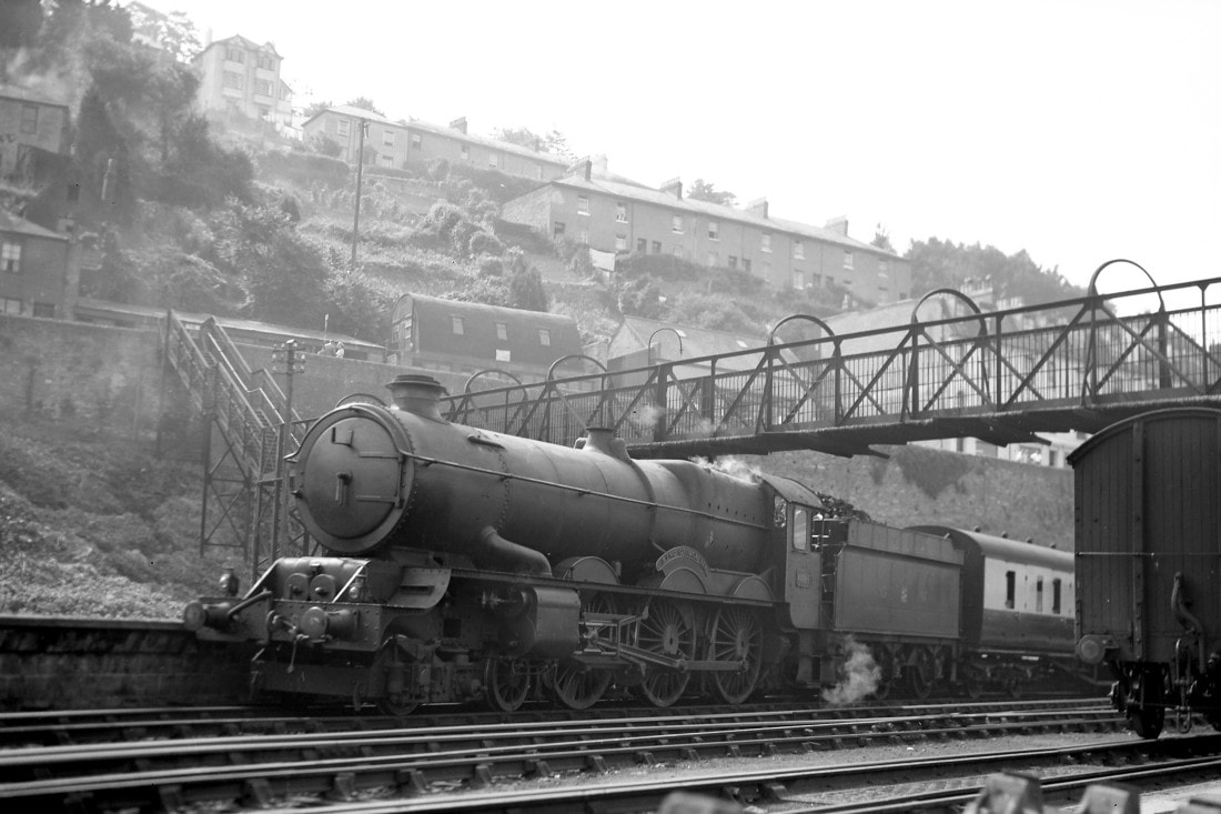
https://reglittle.wordpress.com/tag/kingswear-history-remembered/ ‘The train went across the Creek Bridge, and my mother thought the mud was sand and said we’d be able to have picnics and play there, needless to say we did play there in the mud! On our arrival we found that we lived over looking the creek, and the railway sidings where the carriage cleaners started work at 5:00am. You could go almost anywhere from Kingswear by rail without having to change – Birmingham, Wolverhampton, Rugby, York, London, Wales etc. We soon learnt that if you helped the engine drivers with the turntable, you would get a ride on the footplate, up over the creek bridge and down to the station, or up to the Torbay Express sidings. I have ridden on many a famous engine, one being the King George V (with the big brass bell) which was sent to the USA in the 1930s and broke their rail speed record’.
|
|
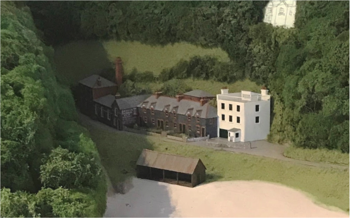
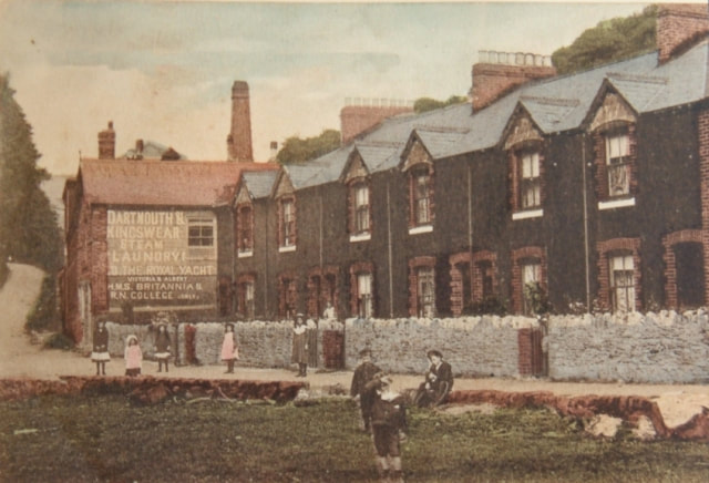
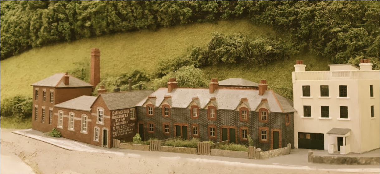
The Dartmouth & Kingswear Steam Laundry stood a little to the north of Kingswear at the end of Waterhead Creek, and in it’s day, it took good care of the uniforms from the Royal Naval college on the opposite bank of the River Dart. We chose to include it as part of the character of the locality and the backwater will soon appear as an interesting 3D layout feature, using forced perspective.
|
Neil Podbery’s additional backscene work on Kingswear has concentrated on the landscaping and scenic foliage cover around the back of the Waterhead Creek area. The laundry buildings appeared alongside the narrow lane leading north towards Brixham, with Paignton and Torquay lying further to the north. The cleared aperture in the tree cover will receive a semi relief facia of the gabled ‘Oversteps’ residence when I can get round to making it.
|
|
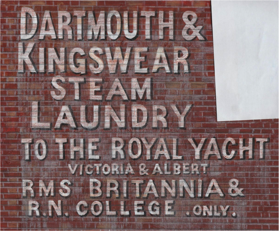
This is a hand drawn artwork of the prominent sign that appeared on the south facing wall of the laundry building as it protruded out to the roadside, just beyond the small front gardens. It’s basically just a tracing of an old hand coloured reference photo, and the cutout is for a south facing window.
|
|
The Dartmouth and Kingswear Steam Laundry was owned by a Mr Mitchelmore, and was managed by the Bell family who lived in one of the Waterhead Cottages between the Laundry and the original mill building (seen to the right). The power for the laundry at that time came from a steam engine, which had a high brick chimney. The water supply came from a stream to the cemetery, which had originally been the leat to the water mill. A large square reservoir was dredged out halfway up Waterhead brake with overshoots and overflows to control the water level. Incidentally, the same pool below the cemetery also supplied the water for the railway station via a pipe along the creek and water tower, which stood alongside the railway cattle pens. This also supplied the railway engines near the turntable. All the machinery in the laundry was driven by overhead shafts and pulleys, which ran the washing machines, calendars and spin dryers. In later years, the brick chimney was demolished and replaced with a tubular steel version.
|
I did find some priceless reference the other day in the ‘Kingswear History’ page, where part of the locality that I’ll be modelling on the next panel is remembered in earlier days by Mike and Jane Trevorrow, who also run a current news page covering local activities.
https://www.bythedart.co.uk/blogs/around-kingswear I hope they won’t mind if I include some edited information here as an example of just how useful these local history accounts can be to researchers. 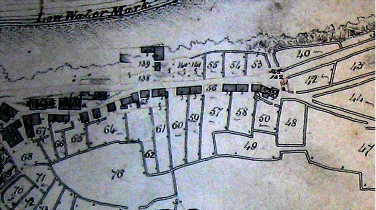
Using old Tythe maps of the area, it seems that ‘many of the unbuilt plots were originally described as gardens. Mike and Jane Trevorrow.
|
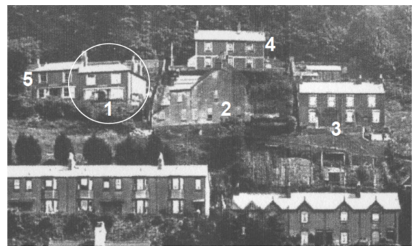
This photo from the 1920s shows the Dart riverbank, and houses are being built to the north of the Church and ferry as the town expands. The side on houses called Overhill (2) which were the first to be built around 1890, then Hawarden Terrace (3) a few years later, followed in 1900 by the Beechcroft pair of semis(4) bordering Higher Contour road; semi detached from Glenhurst(5) and, Killiney(1) , (which was built with semi glazed red brick with yellow brick quoins and window framings) completed the group in 1908. They couldn’t decide which road to adopt for it’s entrance, and so took both Wood Lane, and Higher Contour Road for access. Mike and Jane Trevorrow.
|
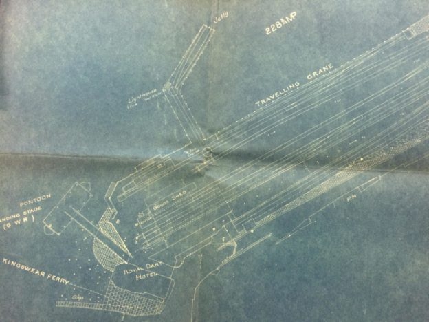
This plan helped to sort out the station end, we even have the stones making up the ferry ramp! The wagon pier with it’s turntables had already gone by the thirties.
|
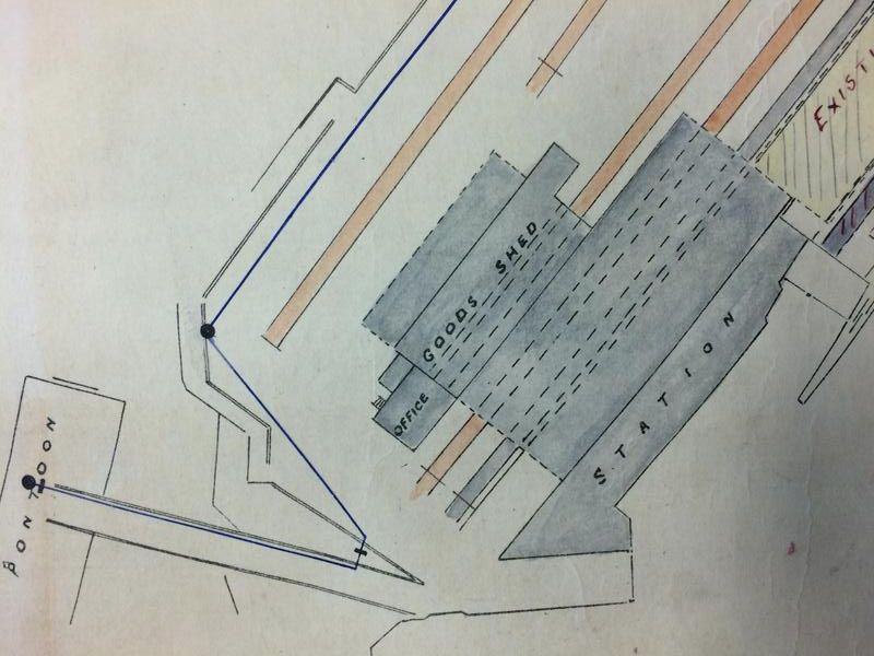
The timber pontoon allowed for the tide, by sliding up and down between two sturdy vertical timber guides at either end.
|
